Announcing the GPT29 Cold Chain White Paper: Engineering-Grade Freezer & Reefer Visibility for Global Logistics
Download the White Paper (PDF): GPT29 Cold Chain Tracking for Freezers — Engineering & Compliance White Paper
Or visit the resource page: GPT29 Cold Chain White Paper (Overview + Download).
Why cold chain visibility is an evidence problem
Overseas cold chain operations fail in predictable ways: temperature excursions go unnoticed, suspected door-open incidents cannot be proven, handling shocks are discovered after the fact, and coverage gaps create missing timelines. The operational cost is not only spoiled product—it is also time spent in investigations, disputes, and claims where teams lack a consistent evidence trail.
When a freezer or reefer shipment is questioned, stakeholders typically need to answer a set of “evidence questions”:
- Where was the asset when conditions changed (port, terminal, handoff, inland leg)?
- When did the excursion start, and how long did it persist?
- Was there a related exposure indicator (often inferred using light exposure events)?
- Was there a related handling incident (shock/vibration event) that correlates with later anomalies?
- Is the data complete, time-consistent, and auditable for internal quality workflows and external claims support?
The GPT29 cold chain white paper is written to help engineering and compliance teams design telemetry that answers those questions reliably—especially on long international routes where dwell time, handoffs, and variable connectivity are unavoidable.
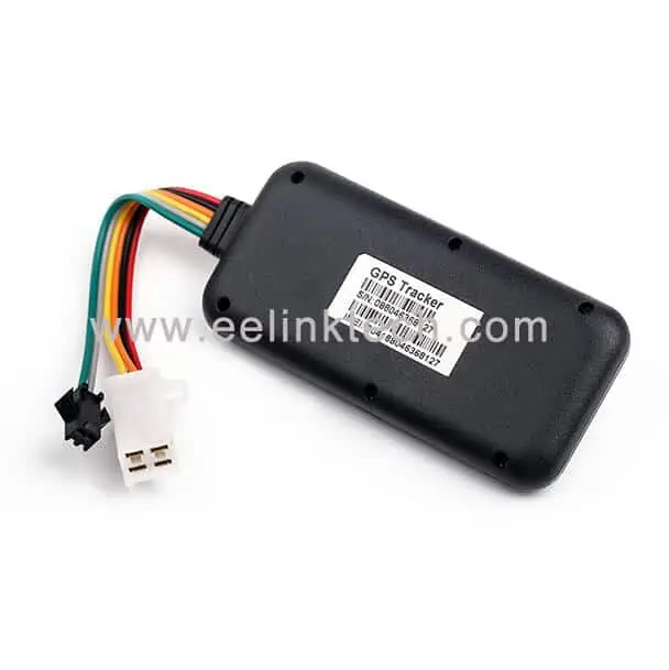
What GPT29 is designed to measure (beyond location)
GPT29 is positioned for in-transit monitoring of cargo and assets. For cold chain use cases, location is only the starting point. The device is commonly evaluated for a multi-sensor evidence stream, including:
- Near real-time location updates with a configurable reporting interval.
- Temperature & humidity telemetry for environmental monitoring and excursion investigations.
- Light exposure events to support suspected door-open / exposure analysis.
- Shock/vibration events to support handling-incident correlation.
You can review GPT29 product background here: GPT29 Global Supply Chain Visibility Tracker (LTE Cat-M1). For broader cold chain monitoring context, see: Cold Chain Monitoring Tracking Device.
Key takeaway: “near real-time” is configurable—and battery life follows policy
In global logistics, the word “real-time” is often misunderstood as continuous reporting. In engineering terms, reporting cadence is a policy decision that directly impacts battery life, data cost, and downstream noise. The white paper therefore recommends a practical approach:
- Baseline reporting at a lower frequency during stable conditions.
- Exception-driven escalation when risk signals appear (temperature excursion, exposure, shock, geofence, etc.).
- Evidence-grade event definitions that record start/end time and duration—rather than “single point” alarms.
This approach is especially relevant for routes like LATAM ↔ North America and LATAM ↔ Europe, where variable coverage and extended dwell windows are common. The white paper explains how teams can plan for a 60+ day mission window depending on interval strategy, environment, and event frequency.
What’s inside the white paper (technical chapters)
Here is a structured overview of what the white paper covers, and why each section matters in real deployments:
1) Mission planning and battery strategy for long routes
How to translate business requirements (e.g., “near real-time during exceptions”) into a reporting policy that protects battery life across weeks of transit. Includes practical concepts like baseline vs exception intervals, offline buffering, and acceptance criteria for a pilot. Related article: Designing a 60+ Day Battery Mission for Freezer & Reefer Tracking.
2) Temperature excursion semantics that survive audits
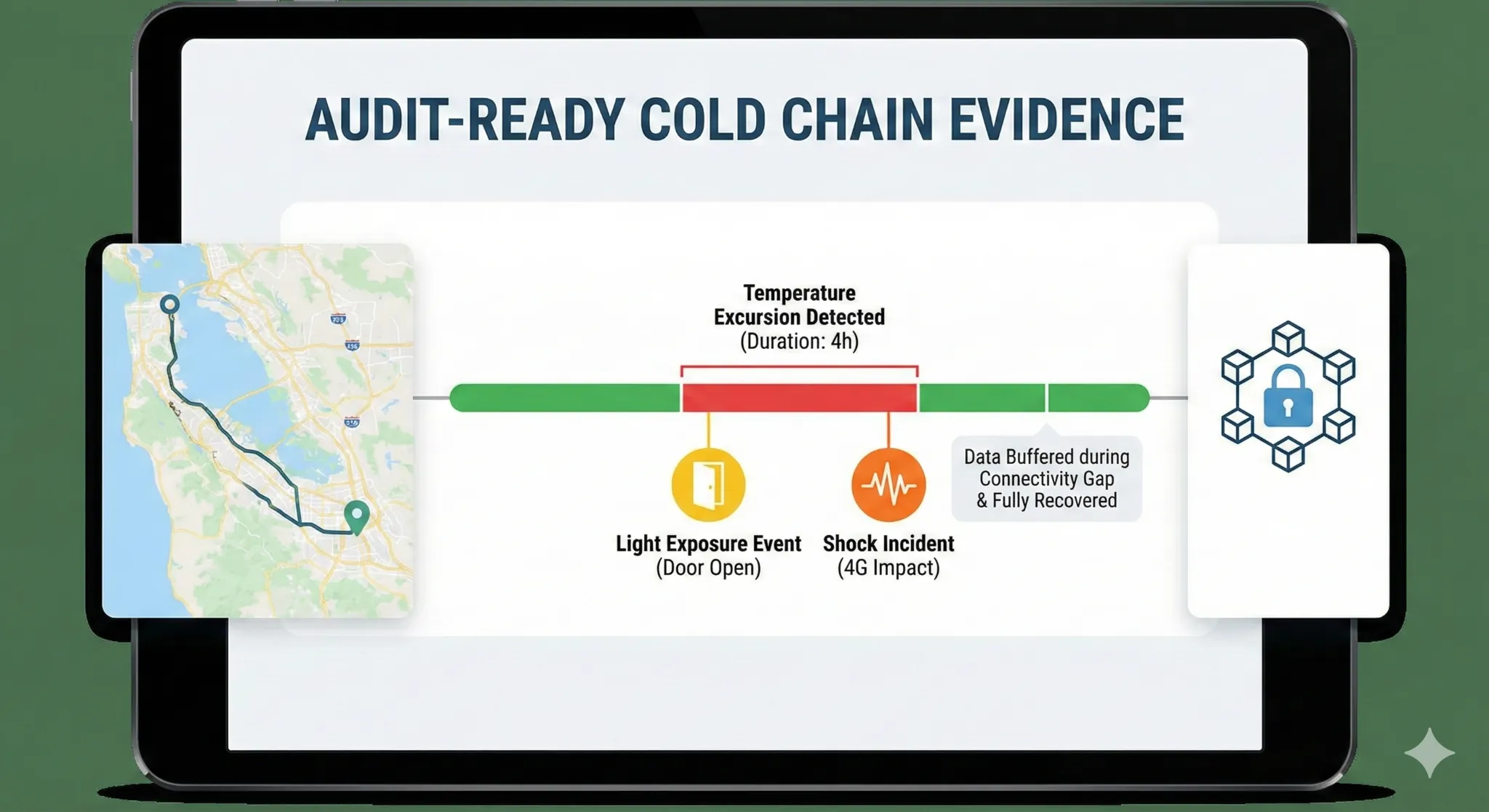
Figure 2: Solving the “evidence problem.” The white paper explains how to correlate temperature excursions with specific handling incidents (shock or light exposure) to validate insurance claims.
Why raw sensor points are not enough for compliance and claims. The paper outlines threshold + duration modeling, hysteresis, and event summarization fields that make excursions reviewable (start/end time, max/min, duration, and context). Related article: How to Define Temperature Excursions (Threshold + Duration).
3) Exposure and handling evidence (light + shock)
How to treat light exposure and shock/vibration as investigative signals rather than marketing buzzwords. The paper explains threshold tuning, false-positive reduction, and correlation strategies with temperature and location. Related articles: Using Light Exposure Events for Door-Open/Exposure Analysis and Shock & Vibration Event Logging for Cold Chain.
4) Data integrity and continuity for international routes
Why coverage gaps happen and how to design telemetry that remains coherent. Topics include buffering, resend logic, idempotency, timestamp consistency, and basic principles for tamper-evident records. Related article: Data Integrity for International Cold Chain IoT.
5) Installation guidance for metal enclosures (freezers and reefers)
Deployment details are often the difference between a successful program and intermittent data. The paper provides practical placement patterns for metal enclosures, mounting reliability considerations, and sensor placement principles. Related article: Installing Trackers on Freezers and Reefer Containers: A Practical Guide.
6) Integration patterns (because many operators already have a platform)
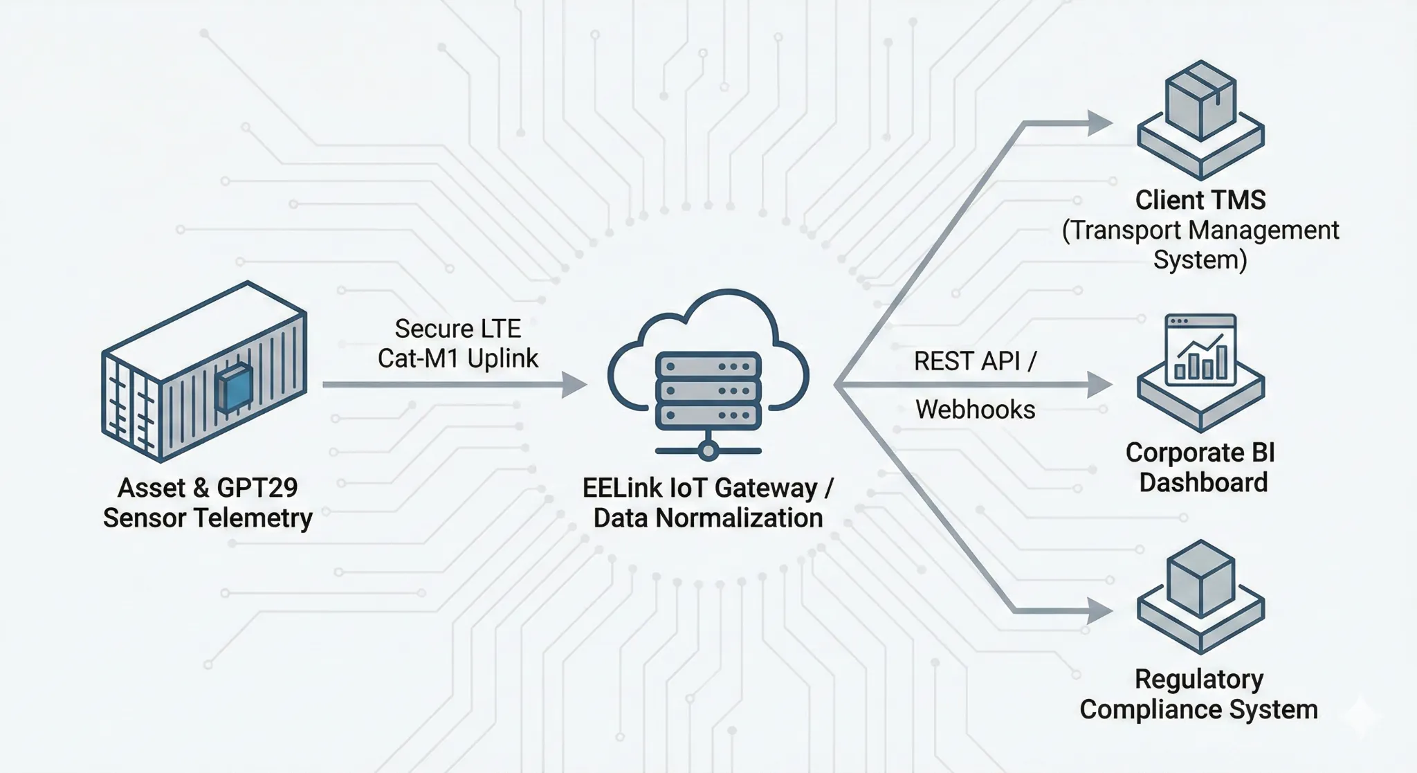
Figure 3: Integration-first approach. EELink allows direct telemetry ingestion into your existing TMS, WMS, or BI platforms via REST API, eliminating the need for proprietary software.
Many overseas operators already run a technology stack (TMS/WMS/data lake/BI). The paper focuses on integration-first patterns—data contracts, ingestion reliability, event normalization, and operational dashboards. Related article: Integrating GPT29 Telemetry into Your Platform (API Patterns + Examples).
7) GNSS positioning vs satellite communication (and what “BeiDou support” really means)
A common confusion is treating positioning satellites as communications satellites. The paper clarifies GNSS multi-constellation positioning versus uplink methods, and provides a decision framework for route planning. Related article: GNSS vs Satellite Communication in Cold Chain Tracking.
Where to start if you’re evaluating GPT29 for cold chain
If you are planning a cold chain visibility rollout, we recommend a pilot designed around measurable acceptance criteria: mission window coverage, data completeness, event quality (not just “alerts”), and integration time-to-value.
For additional reading on cold chain monitoring, you may find these EELink articles helpful: How Cold Chain Monitoring Can Revolutionize Your Supply Chain and Data-Driven Cold Chain: IoT Anomaly Detection & Predictive Analytics.
Download the white paper
If your role touches cold chain engineering, operations, or compliance, this white paper is designed to be immediately useful. It is intentionally practical—focused on reporting strategy, event definitions, installation realities, and integration patterns for overseas routes.
Download (PDF): GPT29 Cold Chain Tracking for Freezers — Engineering & Compliance White Paper
Resource page: https://www.eelinktech.com/gpt29-cold-chain-white-paper/
For pilot or integration questions, contact EELink via Contact Us or email [email protected].
FAQ (Quick Answers)
Do we need to use a proprietary platform?
No. The GPT29 approach is compatible with an integration-first model. Many operators ingest telemetry into their own platform and run alerting, workflows, and reporting internally. The white paper focuses on data contracts and ingestion reliability patterns you can apply in your system.
Is it realistic to get “real-time” updates on long ocean routes?
Reporting policy should be aligned to risk and mission duration. The white paper recommends near real-time during exceptions, with a baseline interval during stable periods—so you can preserve battery while still capturing meaningful events.
What is the difference between GNSS and satellite communication?
GNSS satellites help compute location (positioning). Satellite communication refers to transmitting data via satellite networks. Many deployments use GNSS for location and cellular IoT networks for data uplink. The white paper explains how to plan routes with that distinction in mind.