Achieving Global Supply Chain Visibility Without Satellites – A Technical Solution Overview
Key Takeaways
- Global supply chain visibility is achievable without satellites by combining IoT trackers and supply-chain visibility solutions, LTE-M/NB-IoT connectivity and cloud analytics.
- Event-driven sensing (tamper, shock, temperature) enables instant alerts while deep-sleep firmware delivers multi-year battery life.
- Roaming across hundreds of cellular networks provides practical coverage on major trade lanes at a fraction of satellite cost.
Achieving Global Supply Chain Visibility Without Satellites – A Technical Solution Overview
Introduction: Rethinking Global Tracking Challenges
Global supply chains span oceans and continents, yet traditional tracking methods still leave large visibility gaps. Only 6% of companies report full end-to-end supply chain visibility today, with most shipments effectively “dark” between handoff points. In the past, achieving real-time global tracking meant expensive satellite-based GPS devices on every container. Satellites do provide worldwide coverage, but they come with major trade-offs: high device and bandwidth costs, large power demands, and reliance on clear skies for GPS signals. These factors made continuous tracking feasible only for the highest-value shipments or specialized fleets.
Manufacturers and logistics providers are now searching for alternatives that can “clear up blind spots” and enable quick response times without the complexity of satellite infrastructure. In fact, approximately 87% of businesses plan to expand their use of IoT sensors to improve operational visibility. The question arises – can we achieve global supply chain visibility without using satellites? The answer is yes. By leveraging IoT devices and tracking solutions, smart hardware logic, and ubiquitous cellular networks, it’s now possible to track shipments worldwide in near real-time without dedicated satellites. In this article, we present a formal technical overview of a satellite-free tracking solution: its architecture, hardware design, configuration templates, and implementation feasibility for global logistics.
From Satellite-Based to Satellite-Free Tracking: Solution Architecture
Solution Overview: Our solution replaces satellite-dependent trackers with intelligent IoT tracking devices that use terrestrial wireless networks and cloud analytics. Each shipment (container, pallet, or asset) is equipped with a compact multi-sensor tracker. These devices still determine location – typically via GNSS (GPS/GLONASS etc.) – but crucially, they transmit data through cellular networks (such as LTE-M and NB-IoT) instead of satellites. The architecture consists of three key layers:
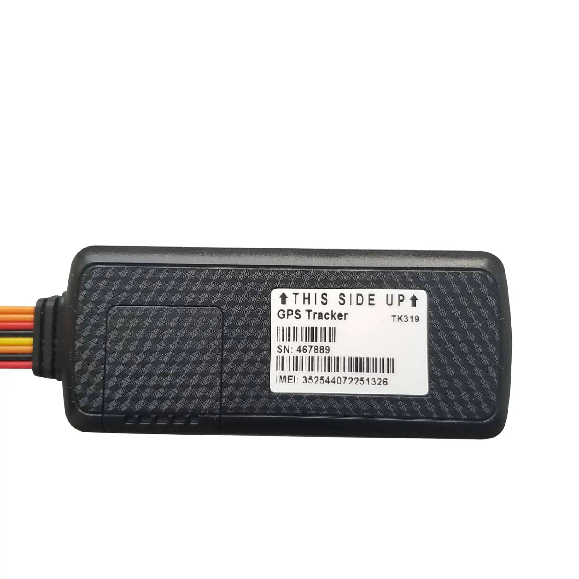
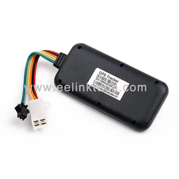
- Smart IoT Tracking Device (Hardware): A rugged battery-powered tracker attached to the shipment. It includes a GNSS module for precise location, plus sensors for environment and security (e.g. temperature, humidity, shock, tilt, door open). The device features an embedded SIM or eSIM that connects to available cellular networks worldwide (LTE-M, NB-IoT, 4G/2G). It runs firmware logic that intelligently manages when to wake, sense, log, and transmit data.
- Global Cellular Connectivity: Rather than a direct satellite uplink, the device leverages the existing global telecom infrastructure. Modern IoT SIM cards can roam on 680+ networks across 180+ countries. Whenever the shipment is in range of any cellular network, the tracker can upload its data. This provides coverage in all populated regions and along most transport routes without the need for costly satellite bandwidth. Even on trans-ocean legs, the device can store data and transmit when it reconnects at a port or coastal area. (In practice, many shipping lanes now have intermittent cellular or LoRaWAN coverage via ports and vessels, but continuous real-time mid-ocean tracking is the one remaining gap we address by data logging.)
- Cloud Platform and Integration: All tracker data is funneled to a cloud-based asset management platform. This central software aggregates real-time location updates, sensor readings, and alerts from every device in the field. Advanced analytics and alerting algorithms run here – for example, geofence breach alerts, temperature excursion warnings, shock event analysis, and predictive ETA calculations. Users access a web dashboard or API to visualize shipments on a map, monitor conditions, and integrate the data into existing TMS (Transportation Management Systems) or ERP software. The platform thus acts as the “operations center,” enabling logistics managers to see movement, location, and condition of inbound components at a glance.
Diagram – How Data Flows: Tracker → Local Cellular Network → Cloud Platform → User Interface/Alerts. Whenever the tracker has data ready (scheduled update or an event trigger), it connects via TCP/IP or MQTT over the cellular network to the cloud. Data packets are kept lightweight (only device ID, timestamp, coordinates, and sensor values) to minimize bandwidth and cost. For example, a typical JSON payload might contain just an ID, time, latitude/longitude, temperature, and battery level. This efficient design keeps airtime usage low, supporting the low-cost, low-power ethos of the solution.
Hardware and Firmware Design: IoT Tracker Without Satellites
The hardware inside each tracking device is purpose-built for long-term, low-maintenance operation – a stark contrast to legacy GPS units that might last only days on a charge. Here are the notable aspects of the device’s design and logic:
- Ultra-Long Battery Life: The tracker carries a high-capacity lithium battery (e.g. 5,000–24,000 mAh depending on form factor). With careful power management, some models achieve 5+ years of operation on a single charge. For instance, Eelink’s new GPT50 pallet tracker uses a 24,000 mAh battery and deep-sleep firmware to deliver up to 5–8 years (≈10 years in ideal conditions) of tracking life. This longevity is possible because the device avoids constant GPS and radio use – it spends most of its time in an ultra-low-power sleep state.
- Multi-Constellation GNSS with Assisted Fixes: To obtain location without draining power, the device wakes only on a defined schedule (e.g. once per 6 hours or once daily) or when triggered by motion. It uses a GNSS receiver compatible with GPS as well as other constellations like GLONASS, Galileo, and BeiDou. This increases chance of a fast fix with minimal wait time. For example, the tracker can achieve a cold start fix in under 35 seconds and hot starts in a few seconds. Faster fixes mean the GPS module is powered for less time per cycle. Some devices also support Wi-Fi and cellular signal fingerprinting as backup – if GPS signals are unavailable (inside a warehouse or container deep in a ship), the tracker can capture nearby Wi-Fi SSIDs or cell tower IDs and later resolve an approximate location via cloud lookup, ensuring “GPS accuracy” location monitoring for shipments across air, sea, road, and rail even when satellites can’t reach.
- Low-Power Wide-Area Network Connectivity: The use of LTE-M (Cat-M1) and NB-IoT is a cornerstone of this solution. These new cellular standards are tailored for IoT: they consume far less energy per byte transmitted than 3G/4G and support extended coverage. The tracker’s modem typically operates in a special power-saving mode (e.g., PSM). During sleep, it draws microamps of current. When it does connect, the data packets are tiny (just a few dozen bytes), and transmission is quick, further conserving power. This is how a device can realistically report once a day and achieve multi-year battery life.
- Event-Driven Sensing and Alerts: Beyond location, the tracker monitors conditions like temperature, humidity, light (for tamper), and shock. Critically, the device firmware uses interrupts and thresholds to avoid wasteful constant sensing. For example, the accelerometer stays active to detect motion or heavy shock, but it only fully wakes the system if a threshold is exceeded (e.g. a drop or movement after a period of stillness). Similarly, the light sensor draws almost no power until it suddenly senses illumination (which would indicate a box or container opened, exposing it to light) – at that point it triggers an immediate alert transmission. This event-driven approach means important incidents (tamper, impacts, temperature breaches) are reported in near real-time, while routine status checks happen infrequently. The result is timely data when it matters, without draining the battery on redundant pings.
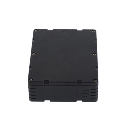
- Rugged & Secure Design: Hardware design considerations ensure the device survives in transit for years. Enclosures are rated IP67+ (waterproof and dust-tight), using robust seals to protect against rain or marine environments. The form factor is typically low-profile and can be mounted securely (for example, flush-mounted under a pallet or inside a container door) to prevent accidental dislodging or easy theft. Many trackers include anti-tamper mechanisms; for instance, one model’s recessed installation under a pallet means it cannot be removed without tools once deployed. These design features ensure the tracker stays on the asset and operational throughout long deployments. Security extends to data as well – communications are encrypted and often use private APNs or VPN tunnels into the cloud system, mitigating the risk of interception on public networks.

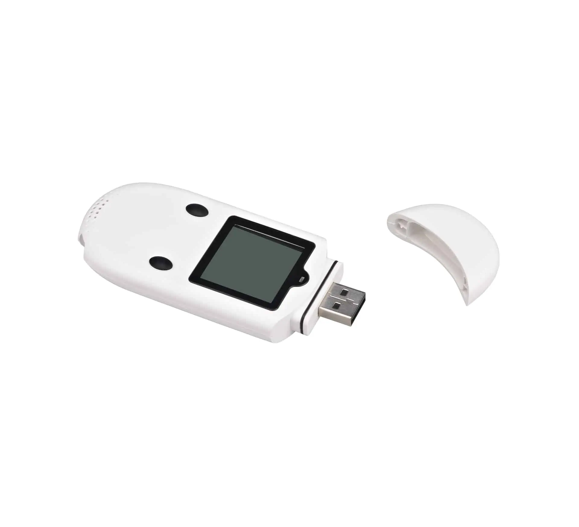
Tamper, shock, temperature, and geofence alerts powered by EELINK IoT tracking devices
In summary, the device hardware and firmware are architected to maximize data collection and minimize energy use. By combining multi-sensor inputs, adaptive sleep schedules, and cellular IoT connectivity, the tracker provides rich telemetry about a shipment’s journey with only a fraction of the power consumption of a legacy GPS/satellite tracker. This makes wide-scale deployment (hundreds or thousands of devices across a supply chain) feasible and cost-effective.
Configuration Templates and Deployment Scenarios
Implementing a satellite-less tracking solution across global shipments requires thoughtful configuration of devices and software. To streamline this, the solution offers configuration templates that tailor the behavior of trackers to different use cases or legs of transit:
- Profile-Based Configuration: Each tracker can be pre-loaded with or remotely assigned a profile that defines its reporting interval, sensor thresholds, and network preferences. For example, an “Ocean Transit” profile might specify very infrequent GPS fixes (perhaps one per day) and no live transmissions (data logged to memory) to conserve power when a container is at sea out of cellular range. Conversely, a “Last-Mile Delivery” profile (for when a shipment is on a truck for final delivery) could enable more frequent position updates, say every 15 minutes, and aggressive geofence alerts for customer-facing tracking. By using templates, operators ensure devices automatically adjust to the optimal settings at each supply chain stage. Profiles can be switched based on geolocation (e.g., arrival at port triggers a mode change via an update command) or via manual remote command from the platform.
- Geofence Libraries and Alerts: The platform allows configuration of geofences (virtual boundaries) around key waypoints – ports, warehouses, borders, customer locations, etc. A library of common geofence templates (for instance “port entry/exit process”) can be applied. When a tracker enters or leaves these zones, it can be configured to send an instant alert. This helps automate logistics milestones without constant manual tracking. For example: “Device 12345 has left Shanghai Port at 14:35” could trigger a status update in the shipping system. Geofence alerts provide contextual visibility (assets where they should be?) in addition to raw GPS coordinates. See our Supply Chain Visibility Solutions page for common milestone templates.
- Sensor Threshold Templates: Templates exist for sensor alert thresholds depending on cargo type. A pharmaceutical shipment might apply a “Cold Chain” template: temperature range +2 to +8 °C, light sensor trigger = any light exposure (container opened), humidity < 70%, shock < X G. A machine parts shipment may be less strict on temperature but very sensitive to tilt (to detect if a crate was tipped). These templates, once set, allow automatic real-time alerts – e.g. if a vaccine container’s internal temperature hits 10 °C, the device will wake and transmit an alert immediately. In our platform integration example, such an event could even be configured to send a Slack notification or trigger a maintenance workflow in real time. For sector guidance, see Industry Solutions.
- Integration and APIs: Deployment also involves integrating the data into business processes. Our solution offers a RESTful API and MQTT subscription feeds so that third-party software can consume the location and sensor data. For instance, a logistics provider can feed tracker data into their transportation management dashboard to visualize all en-route shipments on one screen. Similarly, exception alerts (like a route deviation or shock event) could be sent to an incident management system or even directly to stakeholders’ email/SMS. Since the platform provides these integration points out-of-the-box, adopting the solution doesn’t require ripping out existing systems – it augments legacy systems with live IoT data, essentially creating a digital twin of the supply chain. This enhances decision clarity for operations teams, who get timely, credible information to act on. Learn more or talk to an engineer.

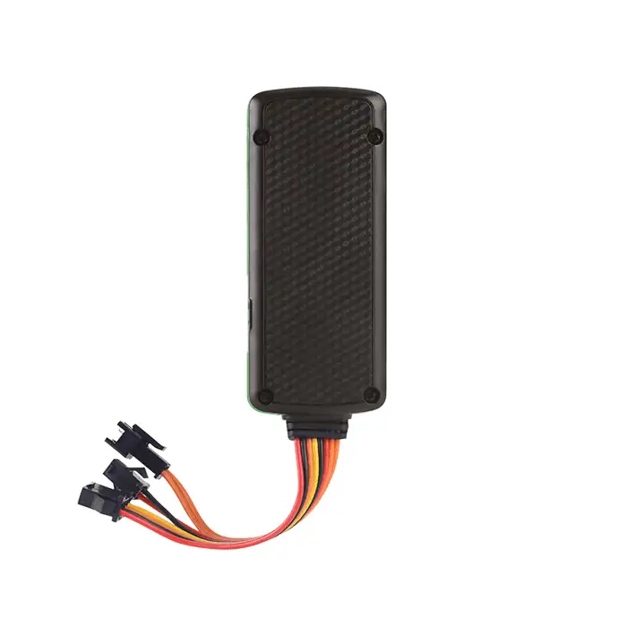
EELINK pallet GPS tracker with 24,000 mAh battery, IP67 rugged design, and multi-year LTE-M / NB-IoT connectivity
During device provisioning, each tracker is associated with an asset (container ABC123, Pallet #56, Truck VIN, etc.) in the software. This way, all data is contextual – users see “Container ABC123 location” rather than just a device ID. Bulk provisioning tools and remote configuration updates allow managing hundreds of trackers efficiently. For example, if a new roaming agreement enables LTE-M coverage in a previously uncovered country, the platform can remotely push an updated network list to all devices (taking advantage of the multi-network SIM capabilities).
In summary, robust configuration and integration capabilities ensure that implementing the satellite-free tracking solution is practically feasible at scale. Companies can define templates once and replicate across devices, and seamlessly integrate the incoming data into their existing workflows.
Implementation Feasibility and Benefits
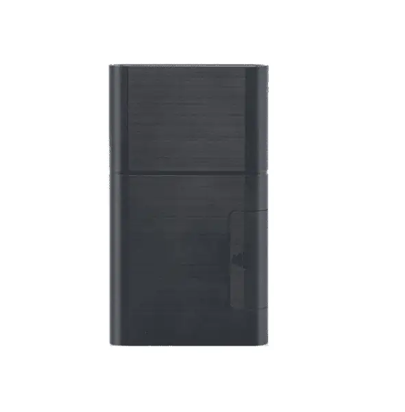
EELINK container GPS trackers delivering real-time visibility from port to global monitoring center
Is a satellite-less tracking solution truly viable for global supply chains? The answer in 2025 is an emphatic yes, thanks to the convergence of IoT technology maturity and network infrastructure:
- Global Cellular Coverage: Cellular networks now blanket the globe’s populated areas and trade routes. IoT-specific networks like LTE-M and NB-IoT have been deployed by over 100 operators and continue to expand. Meanwhile, global IoT SIM providers offer roaming on hundreds of networks. For example, one platform unifies 680+ networks in 180+ countries into a single IoT connectivity service. This means a tracker attached to a container can land in virtually any country or region and find a partner network to transmit data. Remote highways, rail lines, and ports increasingly have at least basic GSM/GPRS or Cat-M1 coverage. In scenarios where coverage is intermittent (e.g., crossing a desert or open sea), the device’s store-and-forward capability ensures no data is lost – it will upload buffered data when connectivity resumes. Thus, while a satellite link might provide 100% continuous coverage, the cellular approach can achieve high coverage in practice for the segments of the supply chain where real visibility is needed (and at a tiny fraction of the cost).
- Cost and Scalability: Satellite links (like Iridium or Inmarsat) often cost tens of dollars per device per month, which is prohibitive to deploy on every pallet or container. In contrast, terrestrial IoT data plans are far more affordable – on the order of a few dollars or less per device monthly, especially given the small data volumes used. Additionally, the trackers themselves use commodity cellular modules and sensors, making them cheaper than specialized satellite trackers. Lower cost per unit means a company can afford to track everything, not just high-value shipments. This democratization of visibility yields huge benefits: fewer losses, proactive delay management, and data-driven optimization. A recent industry analysis noted that cargo theft alone costs global supply chains $30–35 billion each year – a loss that better tracking and quick response can help reduce. By implementing our solution, logistics providers enhance security (theft detection, route deviation alerts) and reduce disruptions. The ROI is realized through prevented stock-outs, improved customer service, and streamlined operations. Notably, 94% of businesses report that supply chain disruptions directly hurt revenue, so the value of real-time visibility in mitigating these issues is substantial.
- Power and Maintenance: A critical feasibility factor is device maintenance – if trackers needed frequent battery changes or manual attention, the solution would crumble at scale. But as described, these IoT trackers are designed to operate maintenance-free for years. For instance, Eelink’s long-life tracker can run 5+ years on one charge and is engineered for multi-year deployment on trailers, containers and other assets. Extensive testing under extremes (–20 °C cold chain, +60 °C hot containers) has proven their durability over time. This means once a device is attached to an asset, it can often remain in service for the asset’s entire journey cycle (or multiple cycles) without intervention. The platform also monitors battery levels remotely, so devices approaching low battery can be flagged for recharge during routine maintenance windows. Overall, the long battery life and ruggedness eliminate the need for a technician to chase down units frequently, making the solution truly scalable to thousands of units in the field.
- Technical Credibility: This satellite-free approach is not science fiction – it builds on proven technologies and standards. Leading industry players and early adopters are already leveraging IoT for supply chain visibility. According to a Gartner forecast, by 2025 50% of large global companies will be using IoT, AI and advanced analytics in supply chain operations. The ecosystem (device OEMs, connectivity providers, cloud platforms) has matured to support this. In short, the technology is ready and available off-the-shelf: robust multi-sensor trackers, global IoT SIMs, and cloud integration APIs. Implementation thus becomes more about organizational readiness and process integration than about inventing new tech. Many companies find that starting with a pilot program – instrumenting a set of containers on a particular lane – quickly proves the concept. The solution’s scalability means moving from pilot to full deployment is primarily adding more devices and perhaps scaling up the cloud instance – no fundamental barriers.
By embracing a satellite-less tracking architecture, supply chain operators gain real-time, data-driven visibility across every leg of transit. The business benefits include:
- Reduced delays and faster exception handling: Knowing exactly when a shipment is stuck in customs or a truck is diverted allows proactive re-routing or customer updates. Real-time alerts let teams tackle issues before they escalate.
- Inventory optimization: Continuous in-transit visibility means companies can operate with lower safety stock. They have confidence to rely on live data rather than large buffers, freeing up working capital.
- Improved customer trust: End customers can receive more accurate ETAs and live tracking links for their orders, much like consumer parcel tracking. This improves satisfaction and transparency in B2B supply relationships, which is why enhancing customer experience is a top priority in modern supply chains.
- Regulatory and quality compliance: For sensitive goods (food, pharma, electronics), automated sensor logs and alerts ensure compliance with handling guidelines. Audit trails of temperature, shock, and door open events are readily available for quality assurance or insurance claims.
- Cost savings: Besides the reduction in loss and disruption costs, avoiding satellites yields direct savings. No special satellite contracts are needed – data rides on existing networks. The trackers themselves avoid the satellite module cost, focusing on affordable cellular chipsets.
Crucially, this solution offers these benefits without requiring organizations to launch any satellites or invest in proprietary infrastructure. It leverages the fact that cellular-enabled sensors and supply-chain visibility solutions now make it possible to track every shipment in real time, without complex infrastructure. In essence, we use widely available technology in a clever way to get nearly the same result that once required orbiting satellites and aerospace-grade equipment.
Conclusion
The transition from satellite-based tracking to a satellite-free, IoT-driven approach marks a significant evolution in supply chain management. We have outlined a solution architecture that combines smart hardware, global cellular connectivity, and cloud analytics to deliver end-to-end visibility for shipments of all kinds – without the need for dedicated satellites. This approach is solution-oriented and technically feasible today, as demonstrated by multi-year battery devices and the broad coverage of IoT networks.
By focusing on robust hardware logic (deep sleep modes, event triggers, multi-network connectivity) and flexible configuration templates, the solution addresses the practical challenges of implementation. Deploying trackers at scale and integrating their data is made straightforward, allowing businesses to quickly move from pilot to full rollout. The result is a supply chain that is “alive” with data – pallets, containers, and vehicles continuously reporting their status – enabling a quantum leap in operational visibility and responsiveness.
For companies seeking to modernize their logistics, the message is clear: you no longer need satellites to know where yo